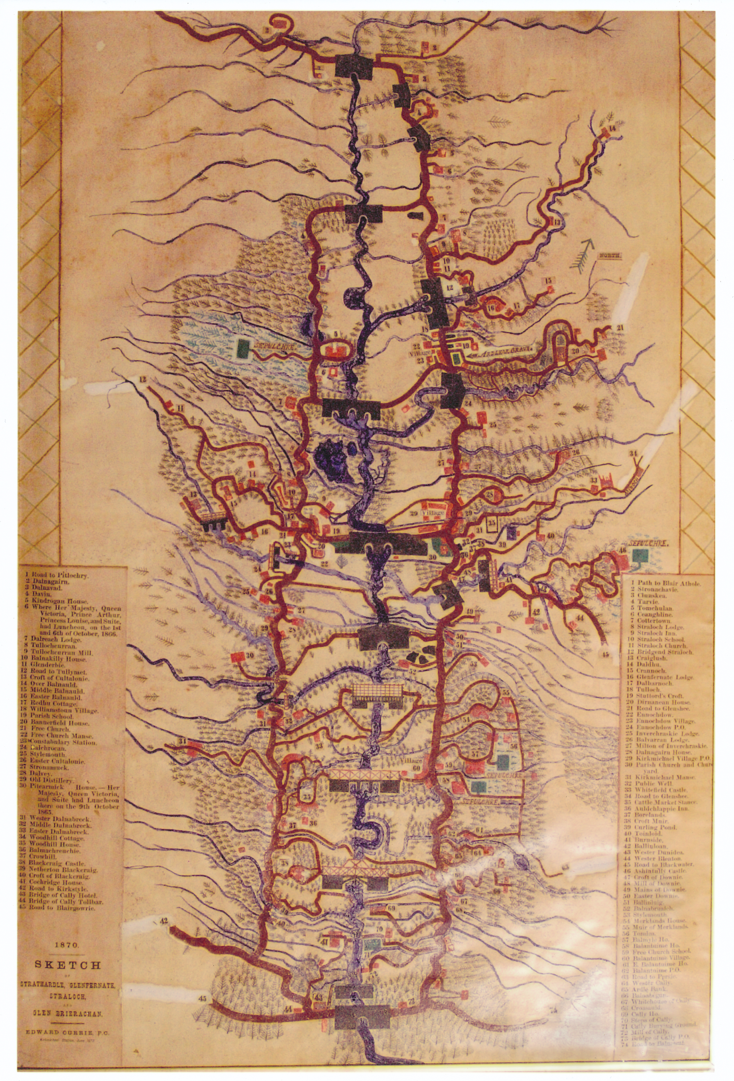
You are here: Home>Complete archive>John Manning Collection>Artifacts>Vellum Map of StrathardleFrom: UpPrevVellum Map of Strathardle From: John Manning Collection An 1870 vellum map called 'Strathardle, Glenfernate, Straloch, and Glen Brierachan'. It was created by Edward Currie, who was a policeman in the area.The map shows very simply where things such as buildings and bridges were in 1870.Creator Edward Currie PC Date of creation 1870 Place Strathardle Contributor John Manning Copyright John Manning Reference number MB/MB01/03/05 Format 1 image No CommentsStart the ball rolling by posting a comment on this page! Add a comment about this pageYour email address will not be published. Required fields are marked *Your comment:Name * Email * Website Save my name, email, and website in this browser for the next time I comment.I consent to my name and e-mail address being stored along with this comment, and to the website editors communicating with me by e-mail about the comment if necessary. My name may be published alongside the comment on the website, but my e-mail address will not be published. My information will not be shared with any third party (see our Privacy Statement - opens in a new window). * Δ Catalogue navigation Alex & Simon Winton CollectionAssorted ItemsBonnie GlensheeDalmunzie FireDalmunzie RailwayDennis Winton Scrapbook Popular keywordsThese are the most popular keywords used on the site.kirkmichael (38)glenshee (29)bridge of cally (21)spittal (20)dalmunzie (19)hotel (19)strathardle (17)school (16)dirnanean (15)ballintuim (15)View all keywordsShare this Facebook Pinterest Twitter Linkedin

No Comments
Add a comment about this page